Nature's Data Loggers
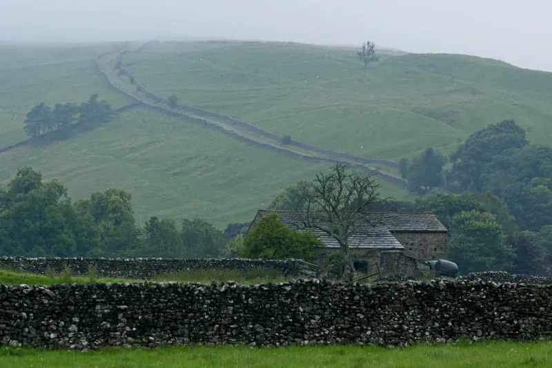
In the grey light of a Norfolk dawn, Dr Emma Richardson crouches over a core of dark sediment extracted from Scolt Head Island's saltmarsh. To the untrained eye, the metre-long cylinder contains nothing more than compacted mud and decaying plant matter. To Richardson, a palaeoclimatologist at the University of East Anglia, it represents a 3,000-year archive of environmental change more detailed than any human record.
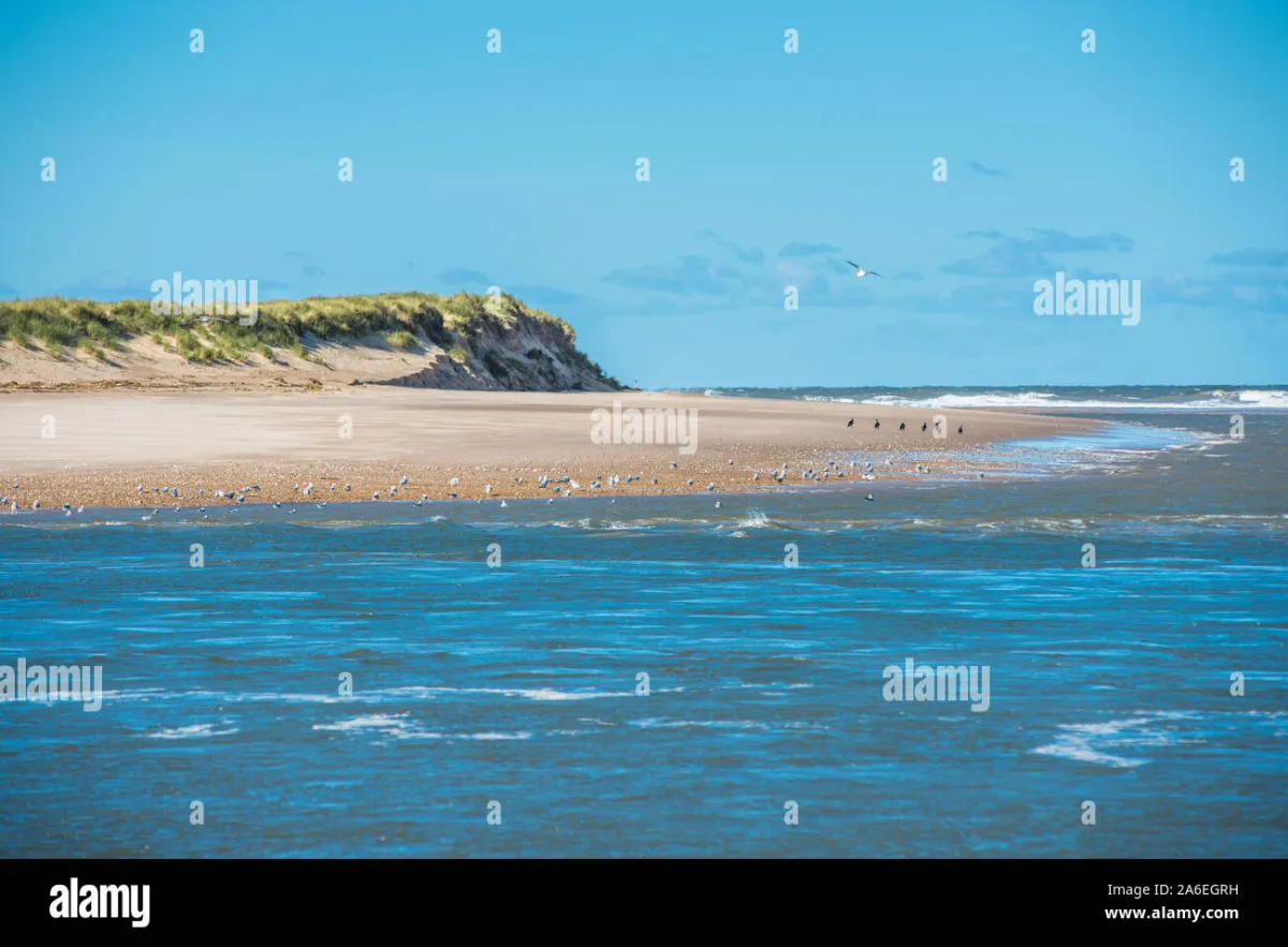 Photo: Scolt Head Island, via c8.alamy.com
"Each layer tells us about storms, temperature shifts, and sea level changes with extraordinary precision," she explains, pointing to subtle variations in sediment colour and texture. "We can identify individual storm events from centuries ago and track how the frequency and intensity of extreme weather has changed over time."
This emerging science of saltmarsh palaeoclimatology is revealing Britain's coastal wetlands to be among the planet's most sophisticated natural recording devices. Unlike ice cores from distant polar regions or tree rings that reflect only terrestrial conditions, saltmarsh sediments capture the complex interplay between land, sea, and atmosphere that defines our maritime climate.
The Accumulation Engine
Saltmarshes function as remarkably efficient sediment traps. Twice daily, incoming tides carry suspended particles of clay, silt, and organic matter across these coastal platforms. As tidal waters slow and spread across the vegetated surface, particles settle out, creating paper-thin layers that accumulate year after year, decade after decade.
The process is so consistent that researchers can achieve temporal resolution approaching annual precision. Radiocarbon dating of organic material, combined with analysis of atmospheric pollutants like lead and caesium, allows scientists to construct chronologies extending back several millennia.
"The beauty of saltmarsh sediments is their continuity," notes Professor Mike Tooley, a pioneer in British sea level research. "Unlike many palaeoenvironmental archives that suffer from gaps or disturbance, healthy saltmarshes provide unbroken records of coastal environmental change."
Decoding the Layers
Within each sediment core lies a complex matrix of information. Microscopic fossils called foraminifera reveal past salinity levels and water depths with startling accuracy. Pollen grains trapped in the mud chronicle changes in terrestrial vegetation, while marine diatoms reflect shifting oceanic conditions. Even the size and composition of sand grains can indicate the energy levels of ancient storms.
Recent advances in geochemical analysis have opened new windows into past climates. Oxygen isotope ratios in shell fragments reveal historical temperature fluctuations, while trace elements reflect changing patterns of precipitation and runoff. Some researchers are even extracting ancient DNA from saltmarsh sediments, reconstructing past ecosystems at the genetic level.
At the Solway Firth, where Scotland meets England, Dr James Shennan's team has used these techniques to reconstruct relative sea level changes over the past 10,000 years. Their work reveals a complex pattern of rise and fall driven by the interplay of global ice sheet dynamics, regional land movements, and local environmental factors.
The Storm Archive
Perhaps most critically for contemporary climate adaptation, saltmarsh sediments preserve detailed records of past storm activity. When exceptional tides or storm surges overtop the normal saltmarsh surface, they deposit distinctive layers of marine sand and shell fragments far inland from their usual sources.
These "overwash deposits" function as geological fingerprints of extreme events. By identifying and dating such layers across multiple sites, researchers can reconstruct the frequency and magnitude of coastal flooding events extending far beyond instrumental records.
Work along Britain's North Sea coast has revealed significant variations in storm activity over the past millennium. The data suggest that periods of intense storminess, such as occurred during the 13th and 17th centuries, may be linked to broader patterns of North Atlantic climate variability.
"Understanding these natural cycles is crucial for distinguishing between climate change and natural variability," explains Dr Cheryl Lowe from the University of Exeter. "Saltmarsh records provide the long-term context we need to properly assess recent changes in coastal flooding risk."
The Wash: A Case Study in Detail
Nowhere is this approach more advanced than in The Wash, East Anglia's vast estuarine embayment. Here, an extensive network of saltmarshes has accumulated sediments for over 7,000 years, creating what researchers describe as Britain's most complete coastal climate archive.
 Photo: The Wash, via m.media-amazon.com
Collaborative research between multiple universities has produced a detailed chronology of sea level change, storm frequency, and coastal evolution spanning the entire Holocene period. The work reveals that current rates of sea level rise, whilst unprecedented in the instrumental record, have been exceeded during previous periods of rapid climate change.
More controversially, the data suggest that The Wash region experienced several catastrophic flooding events during the medieval period that dwarf anything in recorded history. These "mega-floods" appear to coincide with periods of solar minimum and volcanic activity, highlighting the complex relationships between climate forcing and regional environmental response.
Modern Applications
This historical perspective is proving invaluable for contemporary coastal management. Traditional flood risk assessments rely on statistical analysis of relatively short instrumental records, typically spanning less than 150 years. Saltmarsh palaeoclimate data extends this baseline by an order of magnitude, revealing patterns and extremes invisible in modern observations.
The Environment Agency is increasingly incorporating palaeoenvironmental data into flood defence planning. Recent assessments of the Thames Estuary's flood barriers, for instance, now consider saltmarsh evidence for medieval storm surges that exceeded the design parameters based on instrumental records alone.
"We're essentially stress-testing our coastal defences against the full range of natural variability," explains Dr Sarah Woodroffe from Durham University. "Saltmarsh records show us what nature is capable of, not just what we've observed in recent decades."
The Preservation Imperative
Yet this scientific treasure trove faces unprecedented threats. Coastal development, agricultural conversion, and sea level rise are eroding Britain's saltmarsh estate at accelerating rates. Since 1945, England has lost over 40% of its saltmarsh habitat, with losses continuing at roughly 100 hectares annually.
Each destroyed saltmarsh represents not just an ecological loss, but the obliteration of millennia of environmental data. Unlike digital records that can be copied and preserved, palaeoenvironmental archives are unique and irreplaceable.
"We're in a race against time," warns Dr Richardson. "Climate change is simultaneously making these records more valuable for understanding environmental change and more vulnerable to destruction. Once a saltmarsh is lost, its archive is lost forever."
Future Frontiers
Emerging technologies promise to unlock even more detailed information from saltmarsh sediments. High-resolution X-ray imaging can reveal seasonal laminations invisible to the naked eye, while advanced mass spectrometry techniques are pushing the boundaries of what chemical signatures can be detected and interpreted.
Some researchers are experimenting with artificial intelligence approaches to pattern recognition in sediment cores, potentially identifying environmental signals too subtle for human analysis. Others are exploring the potential of ancient biomolecules preserved in saltmarsh sediments to reconstruct past ecosystem functioning at unprecedented resolution.
The Climate Connection
As Britain grapples with accelerating climate change and rising seas, saltmarsh palaeoclimate research offers both sobering warnings and unexpected hope. The records reveal that our coastal environments have survived dramatic changes before, but they also highlight the unprecedented rate of current transformation.
Perhaps most importantly, this research demonstrates that understanding our climate future requires reading the lessons written in mud. In an age of sophisticated computer models and satellite observations, some of our most valuable climate data lies buried in the humble sediments of Britain's coastal marshes—archives that capture the full complexity of our changing planet with a precision that technology has yet to match.